 Polish Polar DataBase
Changes of firn line of Werenskoildbreen and Hansbreen between 2011 and 2017
Firn extents of Hansbreen and Werenskoildbreen delivered from unsupervised classifications of single, dual and fully-polarimetric SAR data (ALOS-2 PALSAR, RADARSAT-2, Sentinel-1, ERS-2 SAR) between 2011 and 2017. Methods of classification: unsupervised ISO classification, H-a Wishart Classification. Results validated with terrestrial measurements (shallow ice cores drilling, Ground Penetrating Radar measurements). Research supported by the European Space Agency, Third Party Missions grant and Svalbard Science Forum, Arctic Field Grant 2018. For more details, please e-mail to this adress:
bbarzycka@us.edu.pl.
- Identification
- Distribution
- Quality
- Spatial rep.
- Ref. system
- Content
- Portrayal
- Metadata
- Md. constraints
- Md. maintenance
- Schema info
Identification
Data identification
Citation
- Date (Publication)
- 2020-12
- Purpose
- scientific and didactic
- Status
- On going
- Maintenance and update frequency
- As needed
- Theme
-
- glaciers facies, glaciers zones, SAR, full-polarimetry, classification, firn line, ELA
- Place
-
- Hansbreen, Werenskoildbreen, Hornsund, Spitsbergen, Svalbard
Legal constraints
- Access constraints
- Intellectual property rights
- Use constraints
- Intellectual property rights
- Spatial representation type
- Grid
- Metadata language
- eng
- Character set
- UTF8
- Topic category
-
- Geoscientific information
- Begin date
- 2011-04-13
- End date
- 2017-04-26
N
S
E
W
))
Distribution
Digital transfer options
- OnLine resource
-
An example of results of the firn area classification for Hansbreen and Werenskoildbreen in 2011.
(
WWW:DOWNLOAD-1.0-http--download
)
An example of results of the firn area classification for Hansbreen and Werenskoildbreen in 2011.
- OnLine resource
-
Extended human readable information about the dataset
(
WWW:LINK-1.0-http--link
)
Extended human readable information about the dataset
Quality
Data quality
- Hierarchy level
- Dataset
Ref. system
- Reference system identifier
- WGS_1984_UTM_Zone_33N
Metadata
Metadata
- File identifier
- dab033a7-edae-4337-8030-3cd429e4a1f7 XML
- Metadata language
- English
- Character set
- UTF8
- Date stamp
- 2020-12-09T11:47:16
- Metadata standard name
- ISO 19115:2003/19139
- Metadata standard version
- 1.0
Overviews
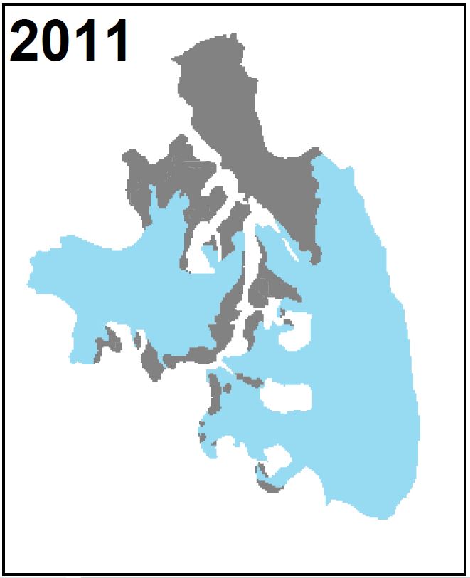
An example of results of the firn area classification for Hansbreen and Werenskoildbreen in 2011.
Spatial extent
N
S
E
W
Provided by

Associated resources
Not available